
- NOAA’s satellites, both polar-orbiting and geostationary, play a crucial role in weather observation and prediction.
- The Joint Polar Satellite System (JPSS) satellites provide detailed data on atmospheric conditions, aiding in weather forecasts up to a week in advance.
- Geostationary Operational Environmental Satellites (GOES) offer continuous monitoring of the Western Hemisphere, facilitating real-time updates on weather and space conditions.
- The collaboration with NASA has enhanced the capabilities of GOES satellites, improving weather forecasting accuracy over the years.
- NOAA’s DSCOVR satellite monitors space weather from a distance of one million miles, with its successor, SWFO-L1, set to continue this mission.
- These satellites underscore our connection to Earth and space, emphasizing our responsibility to safeguard the planet’s future.
High above our ever-changing planet, a fleet of satellites silently stands guard, mapping the ebbs and flows of Earth’s weather like sentinels of the sky. Launched by the National Oceanic and Atmospheric Administration (NOAA), these celestial observers offer detailed snapshots of a world constantly on the move, providing us with crucial insights into weather patterns and environmental shifts.
Underpinning this heavenly gaze are NOAA’s polar-orbiting satellites, gliding 512 miles above Earth’s surface along a path that takes them over the poles. Known as the Joint Polar Satellite System (JPSS), these agile satellites—including the NOAA-20, NOAA-21, and the NOAA/NASA Suomi NPP—trace our planet 14 times a day. With each orbit, they weave a rich tapestry of data, capturing minute details of atmospheric temperatures and moisture levels. This treasure trove feeds into weather models, predicting conditions up to a week in advance and helping humanity prepare for what lies ahead.
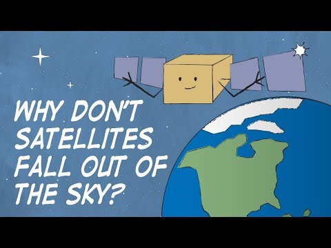
While polar orbiters dart in a tight dance around Earth, the Geostationary Operational Environmental Satellites (GOES) conduct their vigilant watch from astride the equator, 22,236 miles up in space. Here, GOES East and GOES West—our Western Hemisphere guardians—hover over vast swathes of the planet, offering a persistent lookout over regions as far-flung as the shores of Africa and the edges of the Arctic. By matching Earth’s spin, they clutch an unwavering stance over critical zones, fanning out their observation capabilities to include real-time lightning mapping and space weather vigilance.
For half a century, these geostationary satellites have enabled a transformative leap in our ability to forecast, observe, and plan. In concert with NASA, each new generation of GOES satellites has brought progressively sharper images and finer atmospheric details, ensuring our eyes in the sky remain ever-keen, even as technology evolves.
Venturing even further, NOAA’s Deep Space Climate Observatory (DSCOVR) orbits a million miles from home, at a gravitational balancing point known as Lagrange 1. It captures a broad view of space weather, which has both dazzling displays, like the auroras, and daunting effects, like disruptions in communication systems. As DSCOVR approaches the end of its lifespan, the upcoming launch of its successor, SWFO-L1, promises to continue this watchful journey later this year, reinforcing our shield against cosmic anomalies.
As we pause to celebrate Earth Day, the symphony of satellites above directs our eyes beyond the blue horizon to the vast expanse of possibilities. Their gaze reminds us of our fragile hold upon this unique world and the responsibility we shoulder. These invaluable companions, with their constant vigilance, ensure we stay informed, connecting us to the rhythm of the Earth and the breath of the cosmos—all in pursuit of a more resilient future.
The Unsung Heroes in Space: How NOAA Satellites Are Transforming Our Understanding of Earth’s Weather
Satellites launched by the National Oceanic and Atmospheric Administration (NOAA) play a crucial role in the constant monitoring and prediction of Earth’s weather and environmental conditions. Here’s an in-depth look at some additional facts, insights, and applications related to these vital spaceborne assets.
Features and Specifications of NOAA’s Satellite Systems
1. Joint Polar Satellite System (JPSS):
– Altitude and Path: These satellites orbit Earth at an altitude of 512 miles, passing over the poles, which allows them to cover the entire globe several times daily.
– Capabilities: JPSS satellites are equipped with sensors like the Advanced Technology Microwave Sounder (ATMS) and Visible Infrared Imaging Radiometer Suite (VIIRS) that provide critical data on atmospheric conditions, sea surface temperatures, and forest fires.
– Contributions: The data from JPSS feeds into weather models, improving predictions of extreme weather events such as hurricanes and snowstorms up to a week in advance.
2. Geostationary Operational Environmental Satellites (GOES):
– Fixed Positioning: These satellites remain fixed relative to a particular position on Earth by orbiting along the equator at approximately 22,236 miles above the surface.
– Advancements: Newer versions of GOES satellites offer high-resolution imagery and real-time lightning mapping, significantly enhancing weather observation capabilities.
3. Deep Space Climate Observatory (DSCOVR):
– Unique Position: Positioned at the L1 Lagrange point, DSCOVR can simultaneously monitor the sun and the Earth, providing critical space weather data.
– Space Weather Monitoring: This satellite helps in understanding phenomena like solar wind, which can affect satellites, power grids, and communication systems on Earth.
Real-World Use Cases
– Disaster Preparedness: By providing early warnings for extreme weather, NOAA satellites enable timely evacuations and preparations, saving lives and reducing economic losses.
– Environmental Monitoring: Track forest fires, oil spills, and deforestation, facilitating environmental conservation efforts and policy-making.
– Agricultural Planning: Help farmers by providing crucial data about weather patterns, which influences crop planting and harvesting schedules.
Industry Trends and Future Predictions
– Increasing Demand for Data: As climate change intensifies, the demand for precise weather forecasting will grow, driving the advancement of satellite technology.
– Technological Advances: Future NOAA satellites are expected to have better spatial resolution and faster data relay capabilities, improving forecasting accuracy.
– International Collaboration: Global data-sharing and collaborations are anticipated to expand, creating a more comprehensive and interconnected network for climate observation and analysis.
Pros and Cons Overview
– Pros:
– Enhanced accuracy in weather forecasting.
– Improved disaster response and management.
– Long-term environmental monitoring enabling sustainable practices.
– Cons:
– High costs associated with development and launch.
– Dependency on technological systems that may fail or become obsolete.
– Potential privacy concerns related to continuous global surveillance.
Actionable Recommendations
1. Stay Informed: Utilize apps and platforms that provide satellite-derived weather forecasts to prepare for daily activities and potential emergencies.
2. Educational Outreach: Support educational programs that teach the public about the importance of satellite data in understanding climate change and preparing for its impacts.
3. Policy Support: Advocate for continued investment in satellite technology and international cooperation to ensure global preparedness against environmental challenges.
NOAA’s satellites stand testament to our technological prowess, providing vital data that protects lives, sustains economies, and safeguards the environment. Embracing these advancements facilitates a more resilient future. For more insights into NOAA’s work and its impact, visit the NOAA website.